Solar & Renewable Energy Solutions Make Energy Projects Easier to Understand
We help solar and energy teams communicate projects and organize the digital, data, and spatial information behind them. From solar power installations and renewable energy developments to large-scale energy infrastructure projects, we support businesses with practical digital solutions that make project information easier to present, review, and manage.
Energy projects often involve complex site conditions, technical information, planning documents, and multiple stakeholders. Bringing these elements together in a clear and organized format can improve communication and support informed decision-making. At TRISET Solutions, we combine photogrammetry, spatial visualization, website development, and data processing to help energy businesses present project details with greater clarity.
Where We Help
Bring Site Detail and Project Story Together
Aerial imagery, mapping, dashboards, and clear digital communication support planning, review, and stakeholder confidence across the clean energy lifecycle.
Aerial & Site Mapping
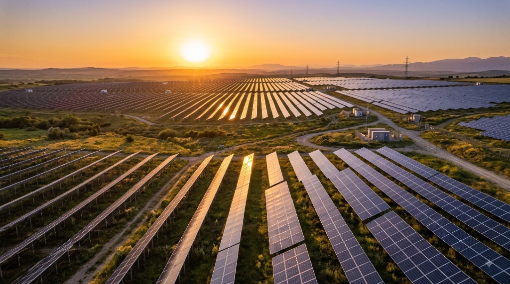
Understanding the site is an important part of planning solar installations and other energy infrastructure. Aerial imagery and mapping help teams visualize site boundaries, surrounding features, access routes, and land characteristics.
TRISET Solutions transforms aerial images and spatial data into orthophotos, mapping outputs, and geospatial deliverables. These outputs support site documentation, preliminary assessment, and clear stakeholder presentations.
- High-resolution orthomosaic maps & boundary overlays
- Solar panel array layout planning & spacing analysis
- Site access roads & transmission corridor mapping
- Surrounding obstacle & shadow assessment reference maps
Terrain & Spatial Visualization
Terrain conditions and surrounding land features influence how energy projects are assessed and presented. Clear spatial visualization helps teams understand the relationship between a project site and its physical environment.
We support terrain workflows using digital elevation models (DEMs), digital surface models (DSMs), orthophotos, and 3D terrain models to communicate site characteristics in an accessible visual format.
- Digital Elevation Models (DEM/DSM) for slope & grade analysis
- 3D interactive terrain models for investor walkthroughs
- Hydrological runoff & watershed topography profiling
- Complementary GIS formats ready for engineering workflows
Project Websites & Presentation
A professional digital presence helps energy businesses explain their capabilities, showcase completed projects, and communicate their value to prospective clients, EPC partners, and institutional investors.
We develop responsive websites and project-focused digital pages that present technical services, project milestones, company certifications, and contact channels in a structured, credibility-building layout.
- Solar EPC & developer capability showcases with case studies
- Interactive project milestone galleries & plant specifications
- B2B RFP enquiry funnels & technical brochure downloads
- Clean, high-performance responsive web architecture
Data Processing & Reporting
Energy projects generate large amounts of information, including survey data, generation records, technical spreadsheets, and regulatory updates. Keeping this information accurate is essential for smooth communication.
TRISET Solutions provides data entry, data cleansing, format conversion, and document digitization to organize project records into structured, presentation-ready spreadsheets, dashboards, and reports.
- Field survey data entry, cleaning & standardization
- Generation log & solar radiation data consolidation
- Regulatory compliance document digitization & archival
- Structured executive dashboards for investor review
Clearer Digital Foundations
Build a Clearer Digital Foundation for Energy Projects
From site mapping and spatial visualization to project websites and organized data, TRISET Solutions helps solar and energy businesses bring critical project information together.
Whether you are preparing project presentations, improving your online presence, or organizing technical survey information, we deliver practical digital support shaped around your business needs.
- Drone Orthophoto Mapping
- 3D Elevation Models (DEM)
- Interactive Plant Portals
- Array Layout Visualization
- Audit-Ready Record Archives
- Multi-Stakeholder Dashboards
Sectors We Empower
Tailored for Every Renewable Energy Venture
Delivering high-accuracy spatial data, technical web platforms, and data pipelines across diverse clean energy categories.
Utility-Scale Solar Developers
Large-scale site mapping, terrain contour DEMs, investor presentation microsites, and regulatory boundary documentation.
Commercial & Industrial Rooftop Solar
Rooftop orthomosaics, shadow analysis maps, B2B proposal websites, and commercial energy savings calculators.
Renewable EPC Contractors
Construction progress orthophotos, engineering capability portals, procurement RFQ workflows, and handover documentation.
Wind & Hybrid Energy Parks
Terrain slope models, turbine placement spatial visualization, transmission line route mapping, and environmental reporting.
Strategic Value
Why Choose TRISET Solutions?
We eliminate communication friction by unifying geospatial photogrammetry, technical web development, and data processing under one reliable team.
🗺️ Geospatial & Web Expertise
Deep competency in processing drone spatial outputs combined with modern responsive web engineering for technical presentations.
🤝 Stakeholder Clarity
Transforming complex topographic contours, boundary coordinates, and engineering specs into accessible, visual digital assets.
📊 Reliable Data Precision
Meticulous data cleansing, survey normalization, and structured reporting workflows that support your existing engineering teams.
Ready to Present with Greater Clarity?
Ready to Present Your Energy Projects with Greater Clarity?
Connect with TRISET Solutions to discuss your project requirements and explore suitable digital, mapping, and data solutions.
Whether preparing project presentations, building a technical website, or digitizing site survey records, our team is ready to assist.